🏗️ CONSTRUCTION SITE MONITORING · CHARTRES (28) · €250–800 LE PASSAGE
Drone construction site monitoring in Chartres
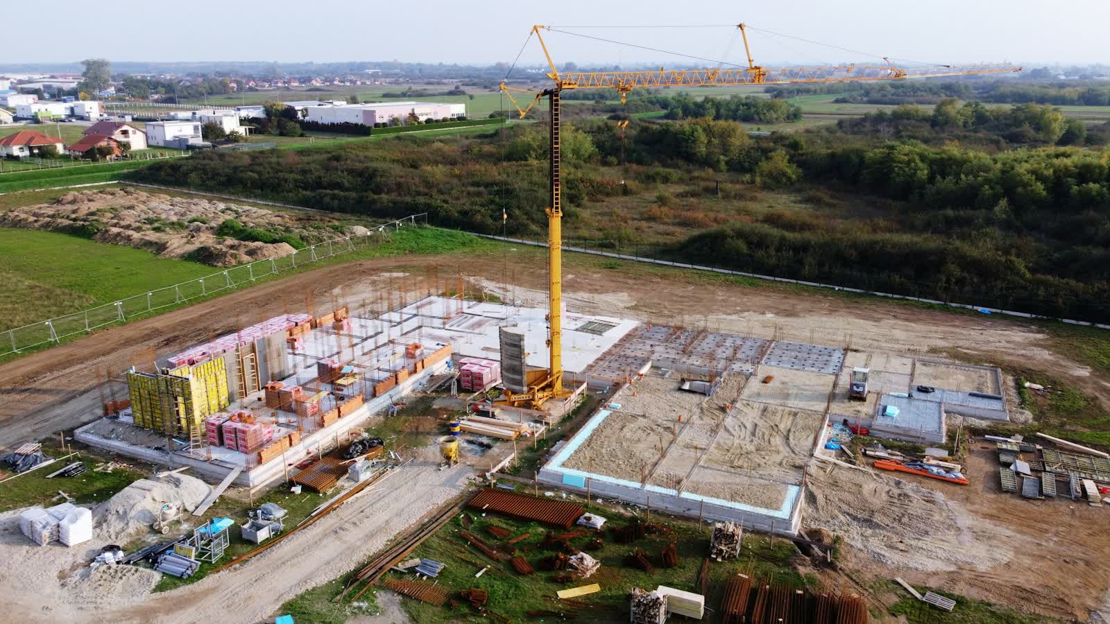
Drone construction monitoring documents progress with a regularity and completeness impossible to achieve from the ground: identical camera angles reproduced at every visit, top-down views of the entire footprint, orthophotos comparable month over month. Project owners, developers and main contractors use it for management (progress records, trade coordination), communication (a spectacular construction timelapse) and pre-litigation purposes (existing conditions, records of neighbouring structures).
The classic formula is a monthly or fortnightly visit for the duration of the project: 20 to 40 photos from the same angles, a flyover video, and optionally a georeferenced orthophoto for overlay on the drawings. At the end of the project, all visits are assembled into a construction timelapse — a communication asset developers value highly for marketing and opening ceremonies.
Free quote — construction site monitoring in Chartres
Rates
€250–800 le passage — the range observed on the 2026 French market, including regulatory preparation, flight and delivery. The exact quote depends on the site, the deliverable and the airspace context in Chartres.
Common use cases
- Monthly progress records for project owners and site meetings
- Construction timelapse of a building or public facility
- Pre-works condition survey of neighbouring structures
- Monthly orthophoto that overlays onto execution drawings
- Earthworks monitoring with cut-and-fill volume calculation
- Marketing communication for a property development
The local context in Chartres
Prefecture of Eure-et-Loir, Chartres is dominated by its Notre-Dame cathedral, UNESCO-listed since 1979: its two dissimilar spires, visible for kilometres above the Beauce plain, its "Chartres blue" stained glass and its crypt make it a mythic aerial subject — subject to monument and urban-area authorisations. The lower town on the Eure, its bridges and wash-houses, and the Chartres en Lumières light festival complete the picture. Chartres-Champhol aerodrome (LFOR) borders the city to the north-east.
The local economy relies on the Cosmetic Valley — the world's leading perfumery-cosmetics cluster (Guerlain, LVMH nearby) —, Beauce agro-industry and services. For drones, the Beauce is a major precision-agriculture terrain (NDVI mapping, crop counts), alongside heritage, real-estate and construction-monitoring missions.
Applicable regulations
A construction site is a controlled area: people present (workers, supervisors) can be considered involved persons if briefed about the flight, which simplifies operations. In clear areas, open category A2 or A3 is sufficient; in built-up areas, recurring visits are flown under the STS-01 scenario with prefectural declaration — the advantage being that one declaration can cover recurring flights at the same location for several months. Height under 120 m, coordination with tower cranes (protocol with the crane operator, no flying through load paths), AlphaTango registration and checking nearby aviation zones on Géoportail, as sites near airports are common.
Frequently asked questions
How often should the drone fly over a site?
Monthly is most common: it matches progress-payment cycles. Fast phases (earthworks, lifting, structural work) justify fortnightly or even weekly visits for a dense timelapse.
Can the drone fly while the crane is operating?
Yes, with a protocol agreed with the crane operator: flight zones and slots defined in advance, radio contact during the flight, and never crossing the load path.
Can site photos be used in a dispute?
Yes: dated, geolocated images reproduced from the same angles are excellent factual evidence of progress or condition. For maximum evidentiary weight, they can be appended to a bailiff's official report.
Can this service be flown anywhere in Chartres?
Almost: Aérodrome de Chartres-Champhol (LFOR); Survol de la cathédrale et du centre soumis aux autorisations d'usage. Depending on the exact location, the pilot picks the right framework (open or specific category) and files the required declarations — included in the quote.
Other drone services in Chartres
- Aerial photography in Chartres from €300
- Aerial video in Chartres from €500
- Real estate drone services in Chartres from €250
- Weddings & events in Chartres from €400
- Roof inspection in Chartres from €200
- Facade inspection in Chartres from €300
- Aerial thermal imaging in Chartres from €500
- Surveying & photogrammetry in Chartres from €800
- Precision agriculture in Chartres from €8
- Security & surveillance in Chartres from €600
- Immersive FPV video in Chartres from €700
- High-access cleaning in Chartres from €500
- Drone pilot training in Chartres from €350
- All services in Chartres
Construction site monitoring near Chartres
- Construction site monitoring in Tours Centre-Val de Loire
- Construction site monitoring in Orléans Centre-Val de Loire
- Construction site monitoring in Bourges Centre-Val de Loire
- Construction site monitoring in Blois Centre-Val de Loire
- Construction site monitoring in Châteauroux Centre-Val de Loire
- Construction site monitoring in Paris Île-de-France
Construction site monitoring: every city →