C-DRONE GUIDE · 2 JUNE 2026
Drone surveying: topographic survey, orthophoto and stockpile prices
For surveying land, producing an orthophoto or computing a stockpile volume, drones have cut lead times fivefold compared with traditional ground surveys. But beware of a common confusion: a pilot with an RTK drone is not a licensed surveyor, and some acts are legally off-limits to them. Here are the real prices of a drone survey in 2026, the achievable accuracy, and the exact boundary between what a drone operator can sell and what remains the licensed surveyor's monopoly.
What a drone can do: topo, orthophoto, volumes
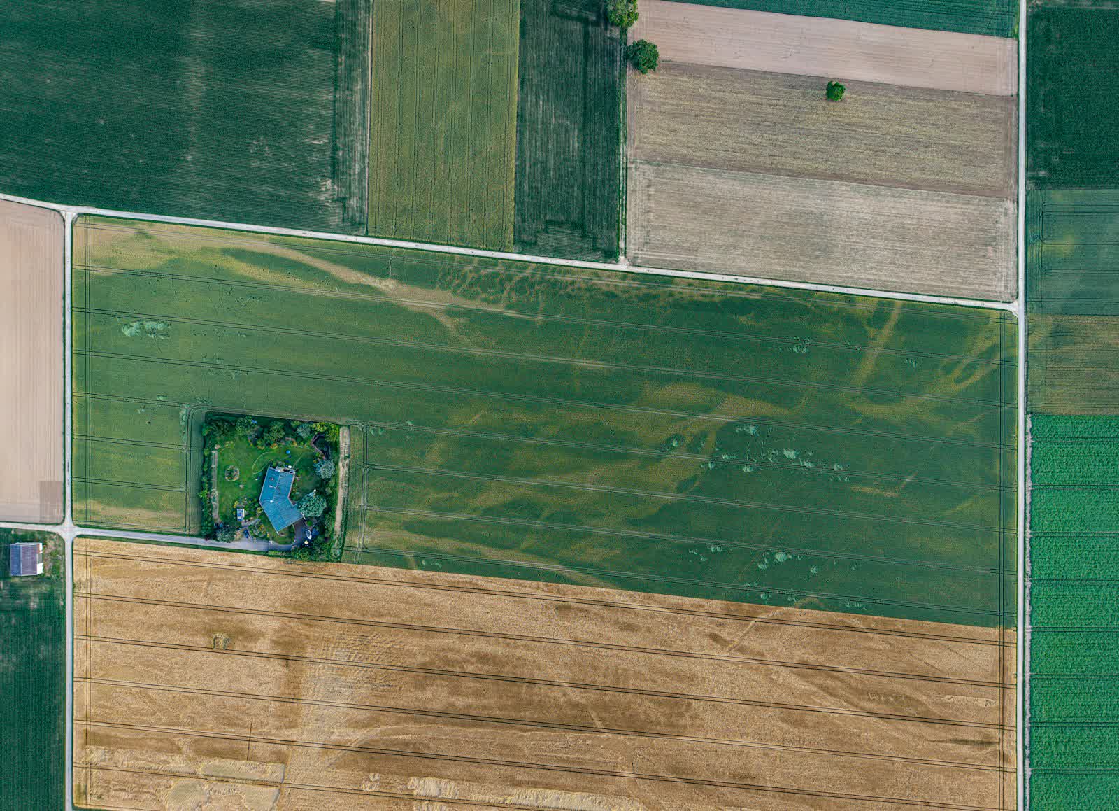
Three deliverables cover most demand. The topographic survey: the drone photographs the plot in high-overlap strips, photogrammetric processing extracts a digital terrain model and a topo plan with contour lines — ideal before a construction project, landscaping or a hydraulic study. The orthophoto: a rectified, georeferenced aerial image, assembled from hundreds of photos, on which every pixel is measurable — municipalities use it for planning documents, site operators for mapping. Stockpile volumes: the volume of an aggregate pile, an earth bund or an excavation, obtained in a few hours where a ground survey took a day, with an accuracy of around 1 to 3% on the volume.
The drone's decisive advantage is measurement density: where a ground surveyor records a few hundred points, the drone captures millions. On rough terrain, partly wooded or dangerous to access (a working quarry, an unstable slope), it is also a safety matter.
What a drone canNOT do: boundary marking
This is the legal point every buyer must know: in France, the delimitation of land property — boundary marking, whether amicable or judicial — is the legal monopoly of the géomètre-expert registered with the Order (law of 7 May 1946). No drone operator, however accurate their equipment, may fix a property line, set a boundary marker or produce a document with legal boundary value. A drone-derived plan can illustrate a file, never settle a boundary.
In practice: for a fence dispute with your neighbour, a plot division before sale or an easement to delimit, you need a licensed surveyor — many of whom actually use drones themselves for the survey part. For everything else — pre-project topo plan, orthophoto, volume monitoring, terrain model — a registered drone operator is enough, at a fraction of the price. Good practice when in doubt: ask whether the deliverable must be legally enforceable against third parties. If yes, licensed surveyor; if it is an internal technical document, drone operator. Some surveying firms subcontract the drone acquisition and sign the final deliverable, a formula combining controlled cost and legal value.
Prices observed in 2026
Ranges observed on the French market, for services by a registered drone operator (fees for a licensed surveyor signing the document come on top):
| Service | Observed price (excl. VAT) |
|---|---|
| Topographic survey of a plot (under 5 ha) | €800 to €2,000 |
| Large area (5 to 50 ha) | €100 to €300/ha, degressive |
| High-resolution orthophoto (housing estate, business park) | €500 to €1,500 |
| Whole-municipality orthophoto | On quote, typically €2,000 to €8,000 |
| Stockpile volume computation (quarry, one site) | €500 to €1,500 |
| Recurring stock monitoring (quarterly contract) | Degressive, -30 to -50% per visit |
| Georeferencing with GNSS control points | +20 to 30% of the total |
Quarries and civil-works companies, which inventory their stocks several times a year, get the best rates by contracting recurring monitoring: flight and processing parameters are reused on every visit, halving production time.
Accuracy: RTK, control points and what to demand
Advertised accuracy always deserves one more question. A consumer drone delivers a model that is proportionally correct but positioned within a few metres. An RTK drone (real-time GNSS corrections) reaches 2 to 5 cm absolute accuracy. Adding independently measured ground control points lets you verify and certify that accuracy — the standard for any deliverable used for design or invoicing. For volumes, relative accuracy matters more than absolute: a careful flight yields volumes reliable to 1-3%, ample for valuing an aggregate stock.
Always demand a processing report stating the ground sampling distance (GSD, in cm/pixel), the number of check points and the measured deviations. A serious operator provides it unprompted. On the regulatory side, a survey in open countryside can be organised within days; near an aerodrome or in an inhabited area, procedures can add two to three weeks — our guide on construction-site photogrammetry covers the building-sector side, and the drone surveying and photogrammetry page covers the full service. For 3D modelling of buildings and monuments, see our dedicated guide on 3D modelling prices.
Frequently asked questions
How much does a drone topographic survey cost?
€800 to €2,000 for a plot under 5 ha, then €100 to €300/ha on a sliding scale beyond that. Certified georeferencing adds 20 to 30%.
Can a drone do boundary marking?
No. Boundary marking is the legal monopoly of the licensed géomètre-expert. A drone plan can document a file, but has no legal value for fixing a property line.
What accuracy for stockpile volumes?
1 to 3% on the volume with a careful flight, which is enough for stock inventories. Quarries save days of surveying and avoid sending staff onto the piles.
Do licensed surveyors use drones too?
Yes, increasingly: the drone surveys, the surveyor checks and signs. If your document must be enforceable against third parties, that is the formula to choose.
Which documents should you provide for an accurate quote?
The plot address or cadastral references, the approximate area, the intended use of the deliverable and the expected accuracy. With these four elements, a serious operator prices the mission within 24 to 48 hours, flight-zone check included.