C-DRONE GUIDE · 7 APRIL 2026
Selling a property with aerial views: the seller's guide
In ten years, aerial views have gone from luxury gimmick to standard fare in quality listings. But not every sale benefits equally, and a botched drone photo can hurt a property. Here is how to decide whether your sale justifies it, what to budget, and exactly what to ask the pilot for.
Which properties genuinely benefit from aerials
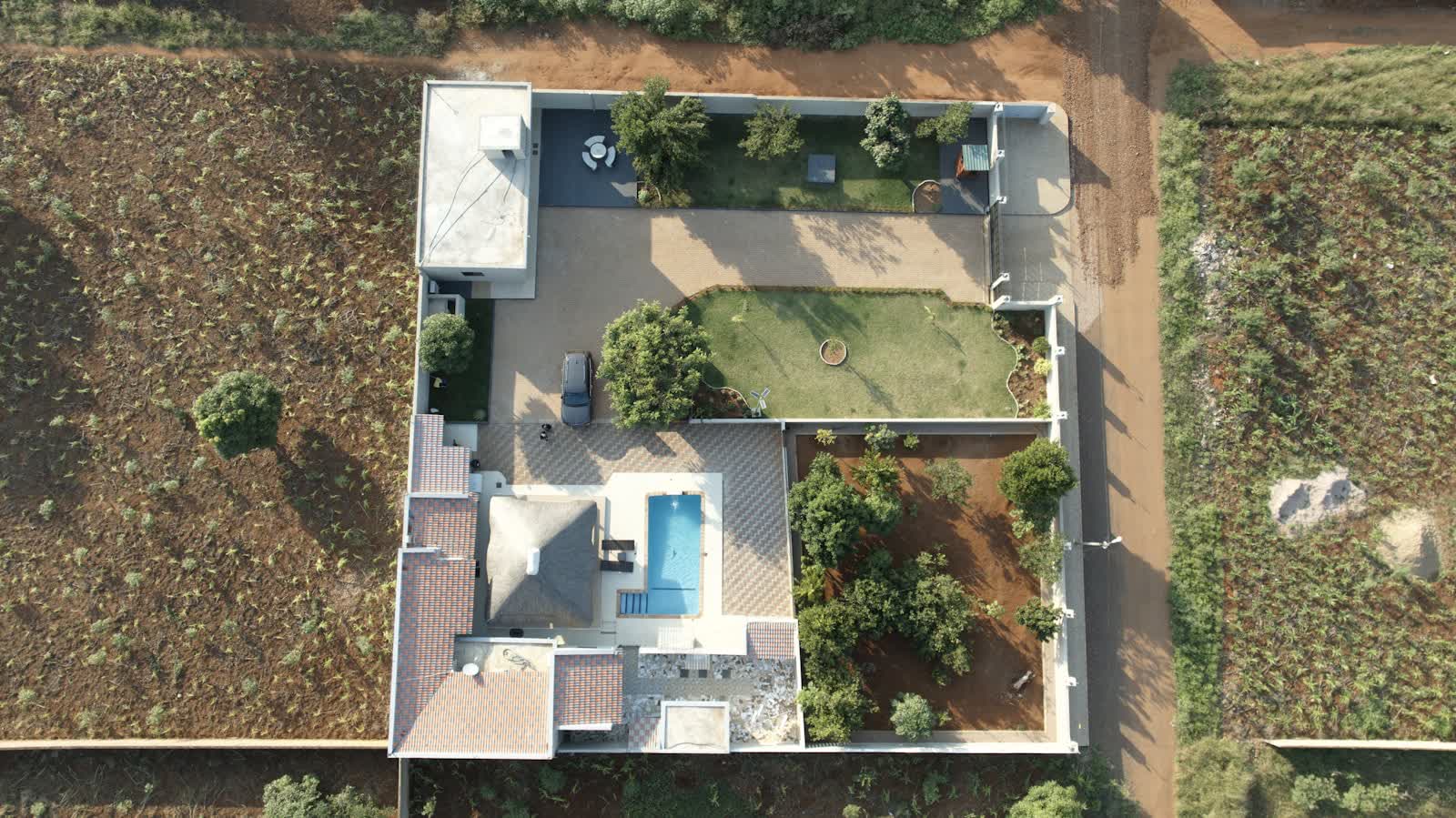
Aerial views sell three things ground photos cannot show: the plot (true surface, boundaries, outbuildings, pool), the surroundings (sea, vineyards, forest, no overlooking neighbours) and the location (real distance to shops, the station, main roads). The properties that benefit most are therefore obvious: houses with over 1,000 m² of land, properties with a view or on the waterfront, farmhouses, estates, building plots whose boundaries need to be shown, and rental buildings where the roof and urban context matter.
Conversely, aerials can hurt: a house squeezed between a ring road and a supermarket will have its flaws exposed from the sky, where ground-level photos would have kept them quiet. Likewise for a flat with no outdoor space, where the drone adds nothing a façade photo does not already say. The decision rule is simple: if the surroundings and the plot are selling points, aerials will showcase them better than anything; if they are the weak spot, save your money. An honest estate agent or a serious pilot will tell you which after two minutes on the satellite view.
What it costs, who pays, and the legal framework
The 2026 French market is well established: an aerial photo pack of 10 to 20 retouched images costs €150 to €300 for a standard house, €250 to €400 with a short 45-60 second video, and €500 to €900 for an estate or prestige property with a full film, dusk shots and social-media versions. Upmarket agencies and agent networks negotiate per-assignment rates (often €120 to €200) thanks to volume. Who pays? Under a simple mandate, almost always the seller; under an exclusive mandate, agencies increasingly absorb the cost into their fees — worth negotiating when signing.
Legally, two scenarios. The property is in a rural or suburban area with no Géoportail restriction: an open-category flight over the plot, with your consent as owner, can be planned within days. The property is in a dense built-up area or restricted zone: prefectoral declaration under the specific category, two to three weeks of lead time and a €100 to €250 surcharge. Since the address determines which scenario applies, any serious quote must start with a check of the aeronautical map — at C-Drone, it is systematic and free.
The brief that makes good photos
A successful real-estate aerial session lasts 45 to 90 minutes on site and follows a precise flight plan. The brief for the pilot fits in five points: the assets to highlight (pool, orchard, open view to the south), the flaws to minimise without concealing (the neighbour's barn, the road), the desired heights — because each height tells a different story: at 10-15 m you flatter the façade and garden; at 30-50 m, the whole plot and its boundaries; at 80-120 m, the setting in the landscape —, the light (late afternoon for a west-facing façade, morning for an east orientation), and the portal-ready images: horizontal framing, the property in the first third of the image.
Also prepare the property as you would for classic photos, but thinking "seen from above": pool cover off, lawn mowed, bins and vehicles moved, garden furniture set out, shutters open. One detail changes everything: the pool. Clean and uncovered, it is a listing's number-one visual magnet; greenish under its winter cover, it sinks the photo. If you can choose the season, May-June and September offer the best foliage-to-light ratio; avoid February, when even a beautiful estate looks grey.
Neighbours' privacy and publishing the listing
Flying over your own plot with your consent poses no difficulty; it is publication that needs some care. Aerial listing photos inevitably show neighbouring roofs and gardens: this is lawful as long as you stick to wide shots without zooming into other people's private spaces (see our guide on image rights). Sector good practice: no identifiable people on neighbouring plots at the moment of capture, blurring at a neighbour's request, and particular caution with neighbouring pools and trampolines, which signal the presence of children.
A word on a growing secondary use: buyers also use aerial images to verify the listing (roof condition, neighbouring solar panels, the high-voltage line at the back of the field). Treat this as a transparency asset: a roof shown from the sky in good condition reassures and cuts short negotiations built on doubt. Conversely, if the roof is tired, better to know before the buyer does — many sellers pair the photo session with a roof inspection by the same drone, billed €80 to €150 extra, to anticipate objections and adjust the price knowingly.
Measuring the return on investment
Should you believe the spectacular figures in circulation ("68% faster sales")? Be careful: these statistics, often American and dated, mix correlation and causation — drone-photographed properties are also the best prepared and best located. What holds robustly on French portals: listings with an aerial visual as the lead photo generate significantly more clicks in search results, and a complete visual file (ground + aerial + video) reduces pointless viewings by better qualifying buyers. On a €400,000 property, a €250 shoot represents 0.06% of the price: it only needs to prevent one hasty price cut or two weeks of carrying costs to pay for itself many times over.
To maximise the return: place the best aerial view second or third in the listing (the first usually stays the façade, which buyers want to recognise), use the video on the agency's social channels and stories, and hold two or three images back to refresh the listing at day 30 with a new visual. Finally, insist on a rights assignment for "listing and sale promotion" with no time limit: if the sale drags on or you switch agencies, your images must follow you.