🏠 REAL ESTATE DRONE SERVICES · ARLES (13) · €250–700 PER ASSIGNMENT
Drone real estate drone services in Arles
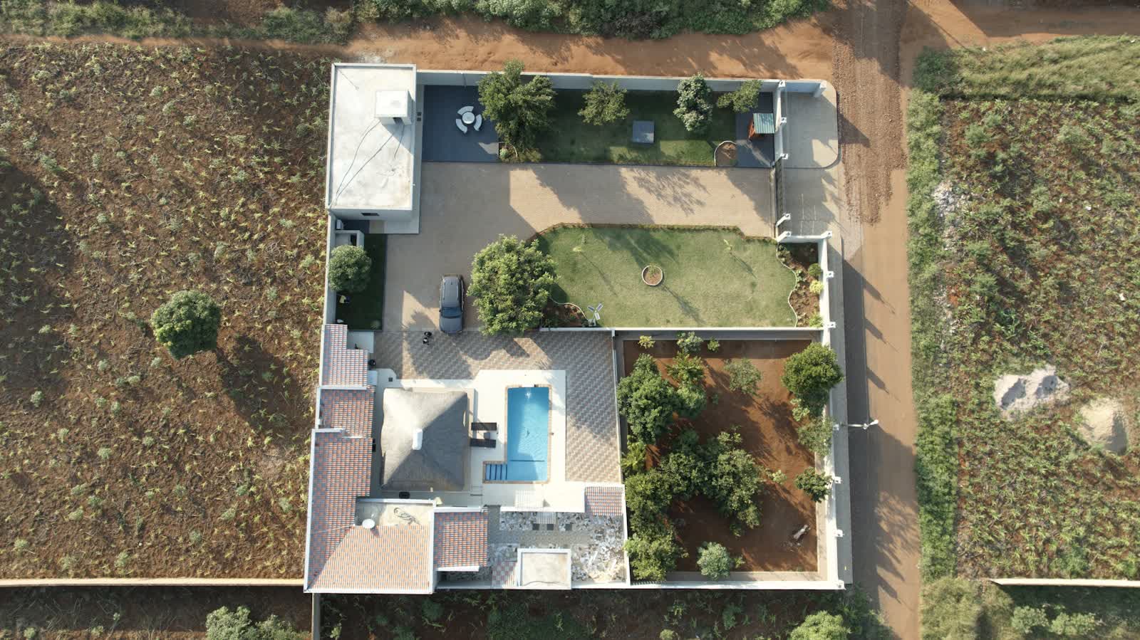
In a competitive property market, a listing illustrated with aerial views stands out immediately: properties presented with drone photos generate significantly more enquiries and sell faster. The drone shows what ground photography cannot: how the house sits on its plot, the view from upper floors, proximity to shops, garden orientation, roof condition.
Our standard real-estate package includes 10 to 20 HDR aerial photos, a 30–60 second vertical video optimised for social media and listing portals, and optionally a full aerial tour of the neighbourhood. Rapid response within 72 hours, delivery within 48 hours: the pace of sales mandates is respected. Agencies, independent agents, developers and private sellers call on us throughout France.
Free quote — real estate drone services in Arles
Rates
€250–700 per assignment — the range observed on the 2026 French market, including regulatory preparation, flight and delivery. The exact quote depends on the site, the deliverable and the airspace context in Arles.
Common use cases
- Aerial photos of a house and its plot for a sale listing
- Drone video of a prestige property or estate
- View from the height of future floors of a new development (view simulation)
- Showcasing a building plot and its surroundings
- Roof and access photos for a pre-sale survey file
- Social media content for estate agencies and independent agents
The local context in Arles
Arles piles up superlatives: mainland France's largest commune (758 km²), a UNESCO-listed Roman and Romanesque ensemble (arena, ancient theatre, Saint-Trophime cloister), Van Gogh's legacy, the Rencontres photography festival and the Frank Gehry-designed Luma tower. To the south stretches the Camargue: a regional natural park and national nature reserve where low-altitude flight is strictly controlled to protect flamingos and birdlife — drones are effectively banned there without authorisation. To the east, the military zones of Istres-Le Tubé air base set their own limits.
The Arles economy lives on culture and tourism, agriculture (Camargue rice, Crau hay) and a river port on the Rhône. Drone demand: heritage documentation (with monument authorisations), rice farming, monitoring of the Rhône dykes — a major issue since the 2003 floods — and audiovisual productions.
Applicable regulations
Most properties are in built-up areas: commercial flights there require the specific category (STS-01 scenario) with prior declaration to the préfecture, or — since 1 January 2026 — an open-category flight over public space (no overflight of people, daytime only), or the use of a sub-250 g drone in sub-category A1 where the layout allows — the most common solution for residential real estate. Maximum height 120 m, operator registered on AlphaTango, respect for neighbours' privacy (no identifiable imagery of third-party properties without blurring), and checking restricted zones on Géoportail: many towns near airfields impose ceilings lowered to 50 or even 30 m.
Frequently asked questions
Do neighbours need to approve photographing a house?
No, but their privacy must be respected: we frame shots to avoid neighbouring properties and blur identifying elements (number plates, people, visible interiors) before delivery if needed.
What is the turnaround from order to delivery?
In unrestricted areas, we shoot within 72 hours and deliver 48 hours after the flight. If a prefectural declaration is needed (town centre, controlled zone), add 10 working days.
Do you offer volume pricing for agencies?
Yes: agencies and agent networks benefit from monthly packages starting at 3 properties per month, with discounts of up to 30% off the unit price.
Can this service be flown anywhere in Arles?
Almost: Réserve naturelle nationale de Camargue (survol réglementé, drones proscrits sans autorisation); Zones militaires de la base aérienne d'Istres-Le Tubé à l'est; Centre ancien UNESCO très fréquenté. Depending on the exact location, the pilot picks the right framework (open or specific category) and files the required declarations — included in the quote.
Other drone services in Arles
- Aerial photography in Arles from €300
- Aerial video in Arles from €500
- Weddings & events in Arles from €400
- Roof inspection in Arles from €200
- Facade inspection in Arles from €300
- Aerial thermal imaging in Arles from €500
- Construction site monitoring in Arles from €250
- Surveying & photogrammetry in Arles from €800
- Precision agriculture in Arles from €8
- Security & surveillance in Arles from €600
- Immersive FPV video in Arles from €700
- High-access cleaning in Arles from €500
- Drone pilot training in Arles from €350
- All services in Arles
Real estate drone services near Arles
- Real estate drone services in Marseille Provence-Alpes-Côte d'Azur
- Real estate drone services in Nice Provence-Alpes-Côte d'Azur
- Real estate drone services in Toulon Provence-Alpes-Côte d'Azur
- Real estate drone services in Aix-en-Provence Provence-Alpes-Côte d'Azur
- Real estate drone services in Avignon Provence-Alpes-Côte d'Azur
- Real estate drone services in Cannes Provence-Alpes-Côte d'Azur
Real estate drone services: every city →