🏠 REAL ESTATE DRONE SERVICES · AUXERRE (89) · €250–700 PER ASSIGNMENT
Drone real estate drone services in Auxerre
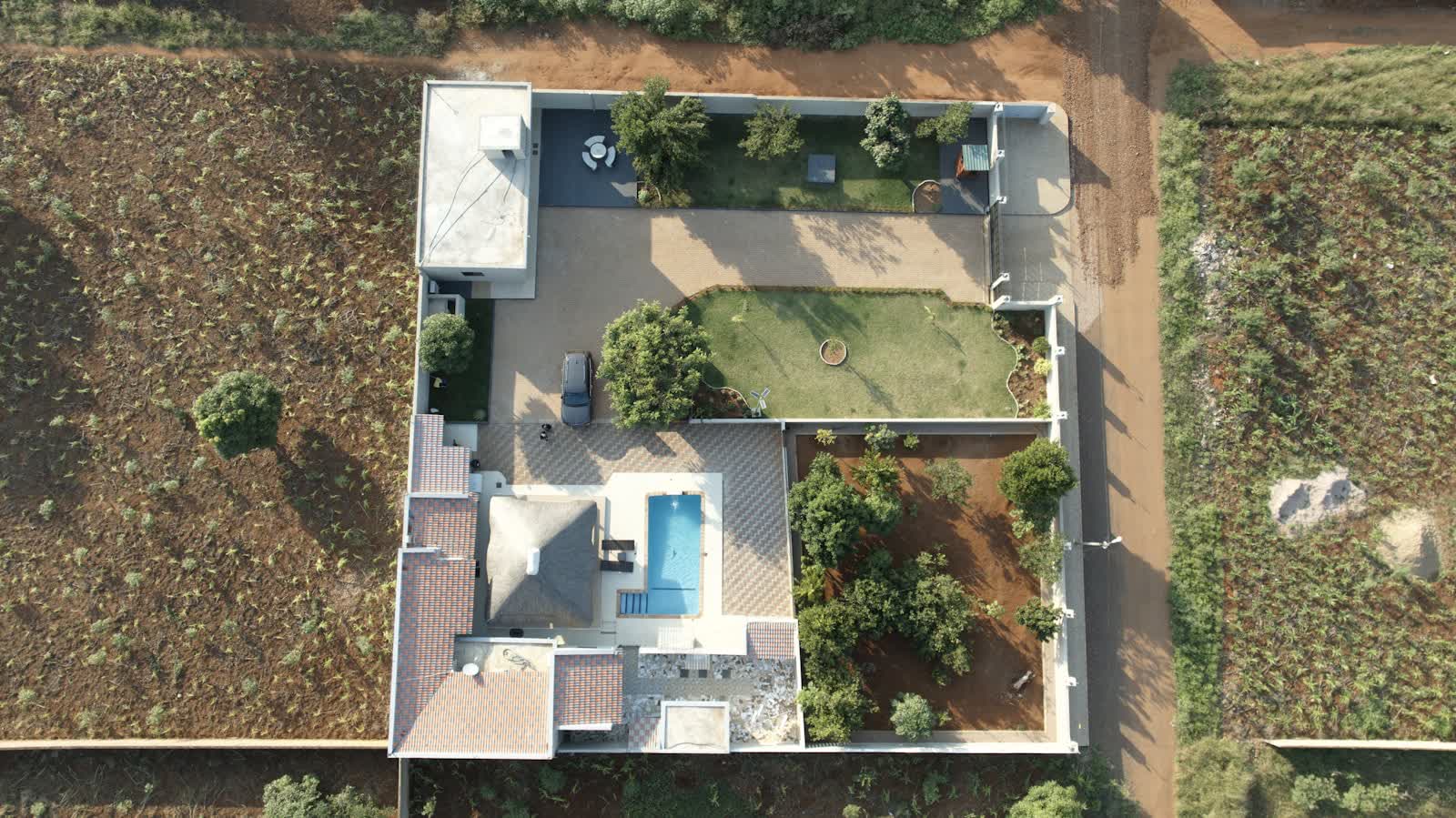
In a competitive property market, a listing illustrated with aerial views stands out immediately: properties presented with drone photos generate significantly more enquiries and sell faster. The drone shows what ground photography cannot: how the house sits on its plot, the view from upper floors, proximity to shops, garden orientation, roof condition.
Our standard real-estate package includes 10 to 20 HDR aerial photos, a 30–60 second vertical video optimised for social media and listing portals, and optionally a full aerial tour of the neighbourhood. Rapid response within 72 hours, delivery within 48 hours: the pace of sales mandates is respected. Agencies, independent agents, developers and private sellers call on us throughout France.
Free quote — real estate drone services in Auxerre
Rates
€250–700 per assignment — the range observed on the 2026 French market, including regulatory preparation, flight and delivery. The exact quote depends on the site, the deliverable and the airspace context in Auxerre.
Common use cases
- Aerial photos of a house and its plot for a sale listing
- Drone video of a prestige property or estate
- View from the height of future floors of a new development (view simulation)
- Showcasing a building plot and its surroundings
- Roof and access photos for a pre-sale survey file
- Social media content for estate agencies and independent agents
The local context in Auxerre
Prefecture of the Yonne, Auxerre offers from the right bank one of Burgundy's finest river skylines: Saint-Étienne cathedral, Saint-Germain abbey with its Carolingian crypts and Saint-Pierre church terraced above the Yonne quays and the marina. The clock tower and half-timbered houses make a highly photogenic old town. Auxerre-Branches aerodrome (LFLA) to the north-west is the main constraint; flights along the Yonne and the Nivernais canal call for the usual care over busy waterways.
The Auxerre economy blends administration, food processing, timber and above all wine: Chablis and its grands crus are twenty minutes away, with the Irancy and Saint-Bris vineyards. AJ Auxerre football club and its stadium complete the local identity. Drone missions: vineyard monitoring (spring frost, harvest), wine tourism, real estate, heritage, river tourism.
Applicable regulations
Most properties are in built-up areas: commercial flights there require the specific category (STS-01 scenario) with prior declaration to the préfecture, or — since 1 January 2026 — an open-category flight over public space (no overflight of people, daytime only), or the use of a sub-250 g drone in sub-category A1 where the layout allows — the most common solution for residential real estate. Maximum height 120 m, operator registered on AlphaTango, respect for neighbours' privacy (no identifiable imagery of third-party properties without blurring), and checking restricted zones on Géoportail: many towns near airfields impose ceilings lowered to 50 or even 30 m.
Frequently asked questions
Do neighbours need to approve photographing a house?
No, but their privacy must be respected: we frame shots to avoid neighbouring properties and blur identifying elements (number plates, people, visible interiors) before delivery if needed.
What is the turnaround from order to delivery?
In unrestricted areas, we shoot within 72 hours and deliver 48 hours after the flight. If a prefectural declaration is needed (town centre, controlled zone), add 10 working days.
Do you offer volume pricing for agencies?
Yes: agencies and agent networks benefit from monthly packages starting at 3 properties per month, with discounts of up to 30% off the unit price.
Can this service be flown anywhere in Auxerre?
Almost: Aérodrome d'Auxerre-Branches (LFLA). Depending on the exact location, the pilot picks the right framework (open or specific category) and files the required declarations — included in the quote.
Other drone services in Auxerre
- Aerial photography in Auxerre from €300
- Aerial video in Auxerre from €500
- Weddings & events in Auxerre from €400
- Roof inspection in Auxerre from €200
- Facade inspection in Auxerre from €300
- Aerial thermal imaging in Auxerre from €500
- Construction site monitoring in Auxerre from €250
- Surveying & photogrammetry in Auxerre from €800
- Precision agriculture in Auxerre from €8
- Security & surveillance in Auxerre from €600
- Immersive FPV video in Auxerre from €700
- High-access cleaning in Auxerre from €500
- Drone pilot training in Auxerre from €350
- All services in Auxerre
Real estate drone services near Auxerre
- Real estate drone services in Dijon Bourgogne-Franche-Comté
- Real estate drone services in Besançon Bourgogne-Franche-Comté
- Real estate drone services in Belfort Bourgogne-Franche-Comté
- Real estate drone services in Chalon-sur-Saône Bourgogne-Franche-Comté
- Real estate drone services in Nevers Bourgogne-Franche-Comté
- Real estate drone services in Paris Île-de-France
Real estate drone services: every city →